Featured Project
The project's purpose is to develop an immersive and interactive Virtual Reality (VR) experience that allows users to learn how to inspect, assemble, and replace ball bearings in a mechanical workshop environment.
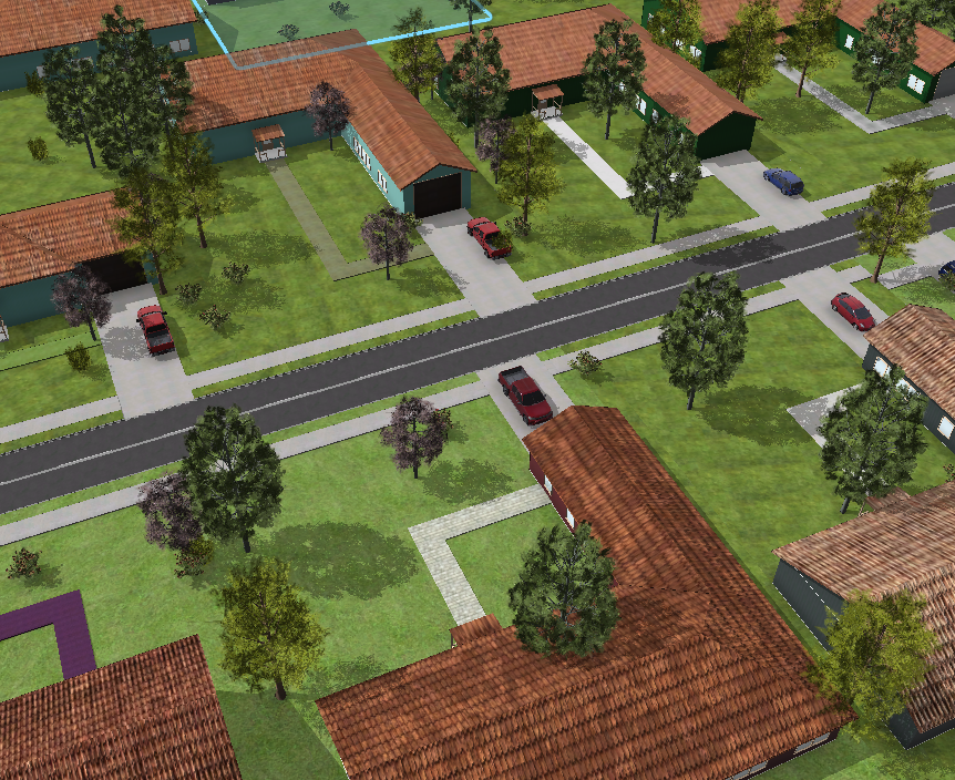
This project aims to integrate Geographical Information System (GIS) to build a 3D virtual environment in Unreal Engine. The chosen model area is in Corvallis, Oregon (see map), selected for its diverse landscapes —including natural areas (grasslands, woodlands, scrub), land uses (farmland, farmyards), and suburban housing. The ultimate goal is to showcase the integration workflow as a case study of the integration of GIS and Graphics to motivate further research and use cases in building the digital twin.
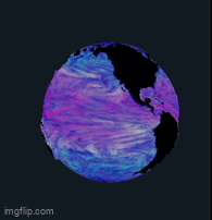
• Utilized ArcGIS Pro to extract and preprocess oceanographic datasets, applying geoprocessing tools and statistical methods to convert ocean flow and temperature data into color-encoded textures.
• Developed a custom shader pipeline implementing the 2D Line Integral Convolution (LIC) technique to visualize ocean currents and temperature gradients on a 3D sphere.